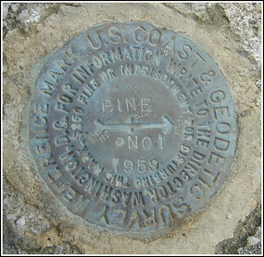
PINE RM 1 (LY1183)
Recovered in Good Condition on October 9, 2004
Spatial/elevation data
| Coordinates | N 41.342166° W 75.276866° |
| Elevation | 1725.27 ft. |
| Location | Pennsylvania
Pike County Newfoundland Quad |
Mark description
| Type | Reference Mark Disk |
| Setting | Boulder |
| Monumented | 1959 by NGS |
| Description (NGS) | NGS Datasheet |
NGS recovery information
Descriptive text
Recovered in good condition. The blazed tree and witness marker no longer exist. This station is located in the Pine Lake section of the Delaware State Forest. To reach the station from the intersection of State Route 507 and Beaver Dam Road north of Greentown, follow Beaver Dam Rd. southeast for 1.55 mi to a gated woods road on the left (the Beaver Dam Trailhead, trail marker no. 120). Follow this trail northeasterly for 0.5 mi then easterly for 0.3 mi, then bushwhack approximately 500 feet directly to the mark atop a low hill.Narrative and photographs
For more information about this reference mark, see its parent mark PINE.
This reference mark was found in good condition as described, set in a boulder in the Pine Lake section of the Delaware State Forest. No blazed trees or witness marker were found at this location.


Recovered in good condition.
Reference mark PINE NO. 1 is set in the top of an exposed outcropping boulder projecting about 1 foot above ground level, and located on a low hill in the Pine Lake section of the Delaware State Forest. The blazed tree and the witness marker no longer exist.


.")