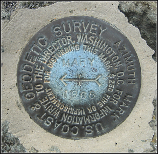
MARY AZ MK (HW3666)
Spatial/elevation data
| Coordinates | N 38.661183° W 78.320233° |
| Elevation | 2297.8 ft. |
| Location | Virginia
Rappahannock County Thornton Gap Quad |
Mark description
| Type | Azimuth Mark Disk |
| Setting | Boulder |
| Monumented | 1965 by NGS |
| Description (NGS) | NGS Datasheet |
NGS recovery information
Descriptive text
Recovered in good condition.Narrative and photographs
For more information about this reference mark, see its parent mark MARY.
This was the second benchmark hunt (and the first totally successful one) of our first day in Shenandoah National Park. Rich and I entered the park in Front Royal, at the northern terminus of Skyline Drive, and spent the rest of the afternoon enjoying a leisurely drive through the northern section of the park, stopping here and there at various overlooks and attractions. The interchange with Route 211 was our stopping point for today, and how appropriate! — an azimuth mark was located somewhere in the grassy area encircled by the exit ramp. A short walk through the scratchy brush brought us directly to a large boulder and the mark set on top. It’s in good condition, and no additions or corrections to the datasheet description are necessary.


