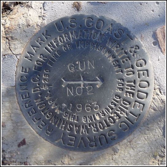
GUN RM 2
Recovered in Good Condition on June 5, 2011
Spatial/elevation data
| Coordinates | N 33.461766° W 111.952266° |
| Elevation | 1315.91 ft. |
| Location | Arizona
Maricopa County Tempe Quad |
Mark description
| Type | Reference Mark Disk |
| Setting | Rock Outcrop |
| Monumented | 1963 by NGS |
| Description (NGS) | NGS Datasheet |
NGS recovery information
Descriptive text
Recovered in good condition. Handheld GPS coordinates for the mark are 33 27 42.4(N) 111 57 08.2(W).Narrative and photographs
For more information about this reference mark, see its parent mark GUN.


