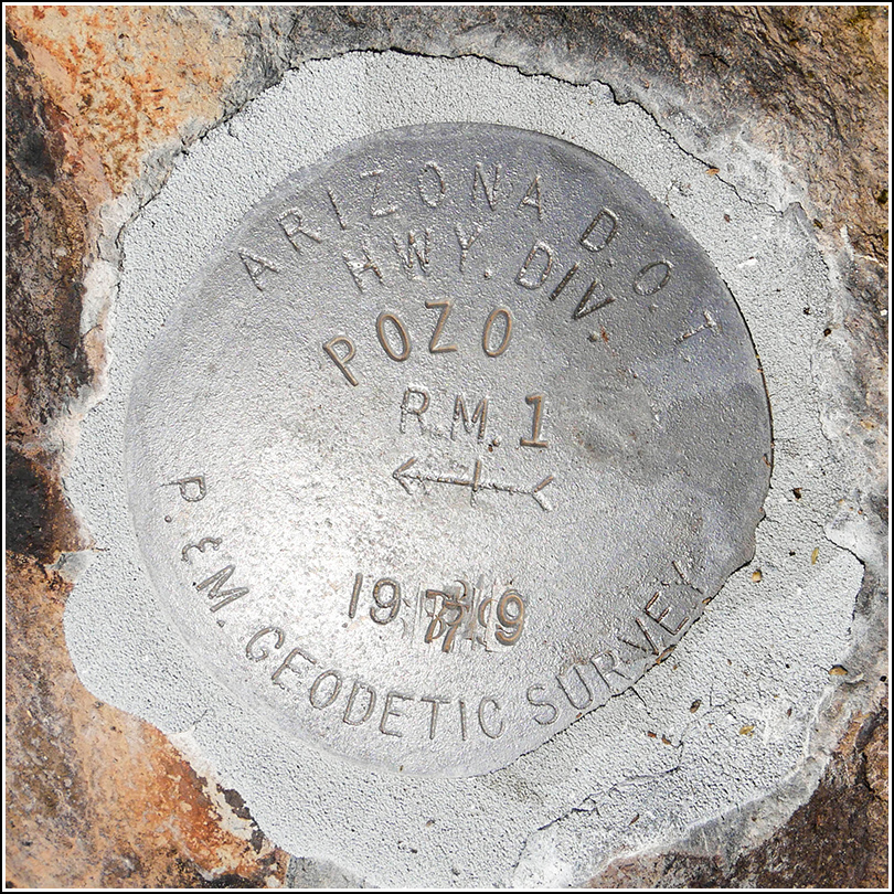
POZO RM 1
Recovered in Good Condition on March 26, 2019
Spatial/elevation data
| Coordinates | N 32.2235° W 112.6805° |
| Elevation | Unknown |
| Location | Arizona
Pima County Gunsight Quad |
Mark description
| Type | Reference Mark Disk |
| Setting | Boulder |
| Monumented | 1979 by AZDOT |
Narrative and photographs
For more information about this reference mark, see its parent mark POZO.

