- NGS PID:
- AI5756
- Coordinates:
- N 38.58668° W 78.36102°
- Location:
- Elevation:
- 3603 ft.
- Type:
- Azimuth Mark Disk
- Setting:
- Rock Outcrop
- Year Established:
- 1959
- Established By:
- NGS
- Status:
- Recovered
- Condition:
- Good as of October 1, 2006
- Official Description: NGS Datasheet
For more information, see: THORO ERDL
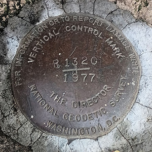
Rich and I walked to this mark from HW3272, as it's less than a tenth of a mile southwest along Skyline Drive. It's located on a huge rock ledge just a few feet east of the road, making for an easy find. The mark appears to be in good condition and the datasheet description is accurate.
A report on the condition of this survey mark has been submitted to NGS, along with the following recovery note:
Disk is weathered but appears to be in good condition otherwise. Found as described.
For more information, see: THORO ERDL