TheSurveyStation
Follow along with Zhanna as she searches for survey marks, airway beacons, and other relics of infrastructure!
Learn moreRecent Survey Mark Recoveries
Browse all recoveries »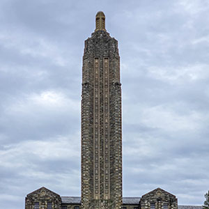
DANVILLE SLOVAK GIRLS ACAD TWR
Montour County, Pennsylvania
April 14, 2025
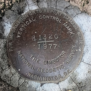
R 1320
San Francisco County, California
December 24, 2024
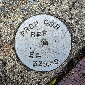
PROP COR REF EL 329.99
Dauphin County, Pennsylvania
October 7, 2024
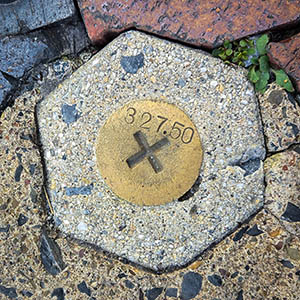
327.50
Dauphin County, Pennsylvania
October 7, 2024