C 17

NGS PID:
AA0923
Coordinates:
N 24.703102° W 81.155305°
Location:
Elevation:
1.55 ft.
Type:
Survey Disk
Setting:
Concrete Post
Year Established:
Unknown
Established By:
Florida DOT
Status:
Not Found
Condition:
Unknown (Not Found) as of February 19, 2014

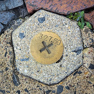
This has to be one of the most beautiful benchmark locations we've ever visited! Unfortunately we were unable to find the mark even after wading around in the water in search of the monument. The area has changed significantly since the mark was described. We found one of the objects used as a reference to this mark, which is a chiseled cross set in the concrete headwall forming the boundary of the pool. Our guess is that the monument may have been destroyed or covered when the boat dock referred to in its description was removed.

A report on the condition of this survey mark has been submitted to NGS, along with the following recovery note:

Mark not found. The pool still exists but there is no longer a boat dock at the site, and no concrete monument was found at the coordinates. The chiseled X and MOSER RM 4 were found. MOSER RM 3 was not found.

Leave a Comment