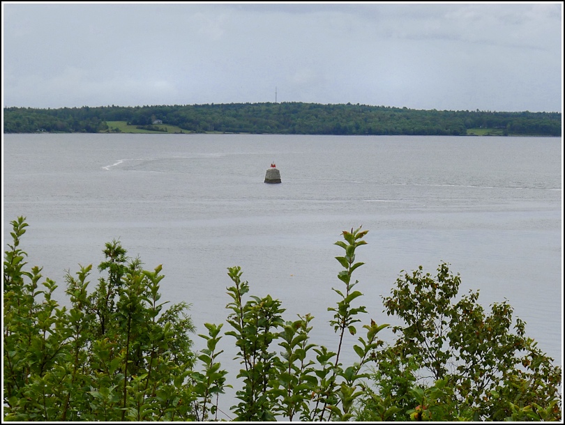
FORT POINT LEDGE BEACON (PE2110)
FORT POINT LEDGE BEACON
Recovered in Good Condition on September 5, 2013
Spatial/elevation data
| Coordinates | N 44.461047° W 68.810089° |
| Elevation | Unknown |
| Location | Maine
Waldo County Castine Quad |
Mark description
| Type | Landmark/Intersection Station |
| Setting | Navigation Light |
| Monumented | Unknown by NGS |
| Description (NGS) | NGS Datasheet |
NGS recovery information
Descriptive text
Recovered in apparent good condition.Narrative and photographs
We recovered this station a year later than we could have. I recall noticing it when we first visited Fort Point last year and entertaining the thought that it might be an NGS station. Why I didn’t take a photo of it then, just in case, I don’t know. But this year I was prepared.
The station consists of a red daybeacon atop a tapered stone base. It is listed in Special Publication #46: Geodesy: Triangulation in Maine, by Walter F. Reynolds (1918). The publication indicates that observations on the beacon were taken in 1911.