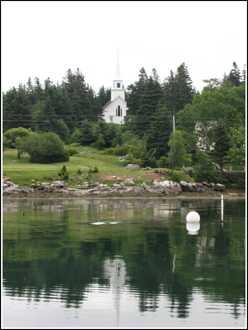
ISLE AU HAUT CHURCH SPIRE (PE2026)
ISLE AU HAUT CHURCH SPIRE
Recovered in Good Condition on June 21, 2008
Spatial/elevation data
| Coordinates | N 44.073766° W 68.63405° |
| Elevation | Unknown |
| Location | Maine
Knox County Isle au Haut West Quad |
Mark description
| Type | Landmark/Intersection Station |
| Setting | Church Spire |
| Monumented | Unknown by Unknown Agency |
| Description (NGS) | NGS Datasheet |
NGS recovery information
Descriptive text
Recovered in good condition.Narrative and photographs
This one may be a bit of a stretch, since we only saw the steeple from the ferry, but we’re recovering it anyway since landmark stations were intended to be sighted on from a distance. The name of the church is Union Congregation Church. It was built in 1857, so we’re quite certain the steeple is the same one observed originally in 1868.
