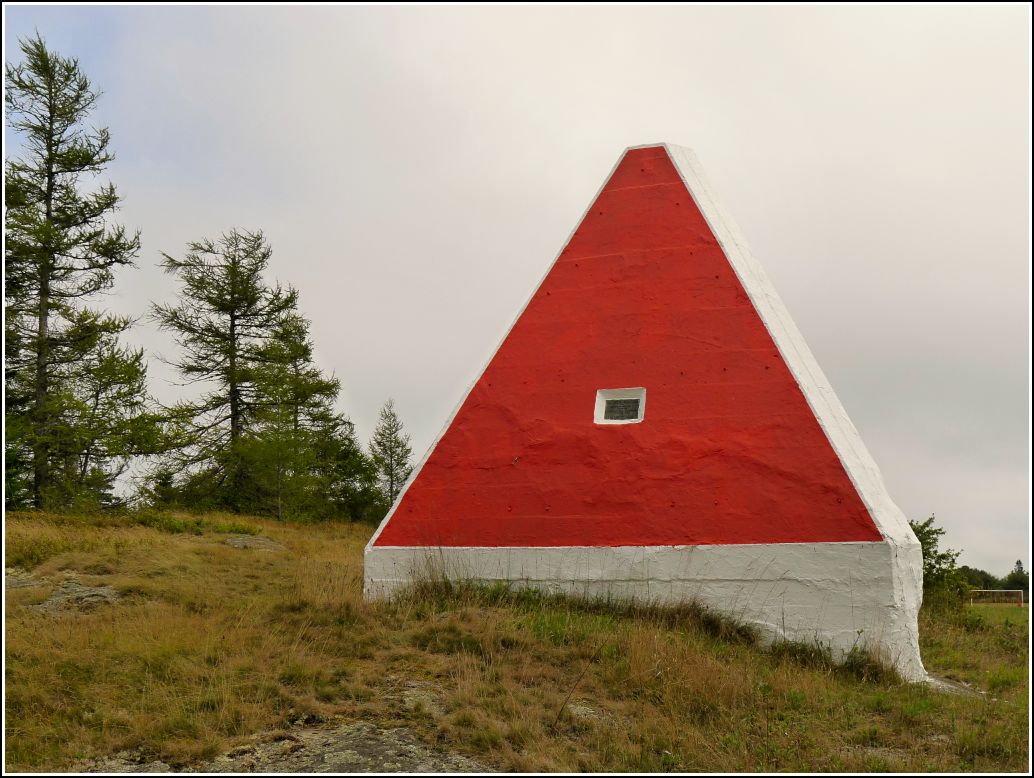
RANGE MARK 8 IBC 1919 (PD0763)
RANGE MARK 8 IBC 1919
Spatial/elevation data
| Coordinates | N 44.909148° W 66.994679° |
| Elevation | Unknown |
| Location | Maine
Washington County Eastport Quad |
Mark description
| Type | Range Marker |
| Setting | Concrete Pyramid |
| Monumented | 1919 by International Boundary Commission |
| Description (NGS) | NGS Datasheet |
NGS recovery information
Descriptive text
Recovered in good condition.Narrative and photographs
This range marker has to be one of the most unusual stations we’ve ever found! Apparently these markers were constructed in pairs to allow for sighting along a line and thereby locating points along the international boundary. We didn’t search for the smaller (front) marker—I’m not even sure if it still exists or where it might be, but I don’t think it’s in the NGS database. After exploring “downtown” Eastport during the morning, we climbed Battery Hill behind the elementary school and walked right up to this station, a huge white pyramid. We took a series of photos of the east-facing side of the pyramid before walking around to the southwest-facing side and realizing that this was the side we should have been documenting! The southwest face is painted red and into the center is embedded a plaque that reads: UNITED STATES — RANGE MARK NO. 8 RANGING INTERNATIONAL BOUNDARY COURSE 1-2 — TREATY OF 1908.

