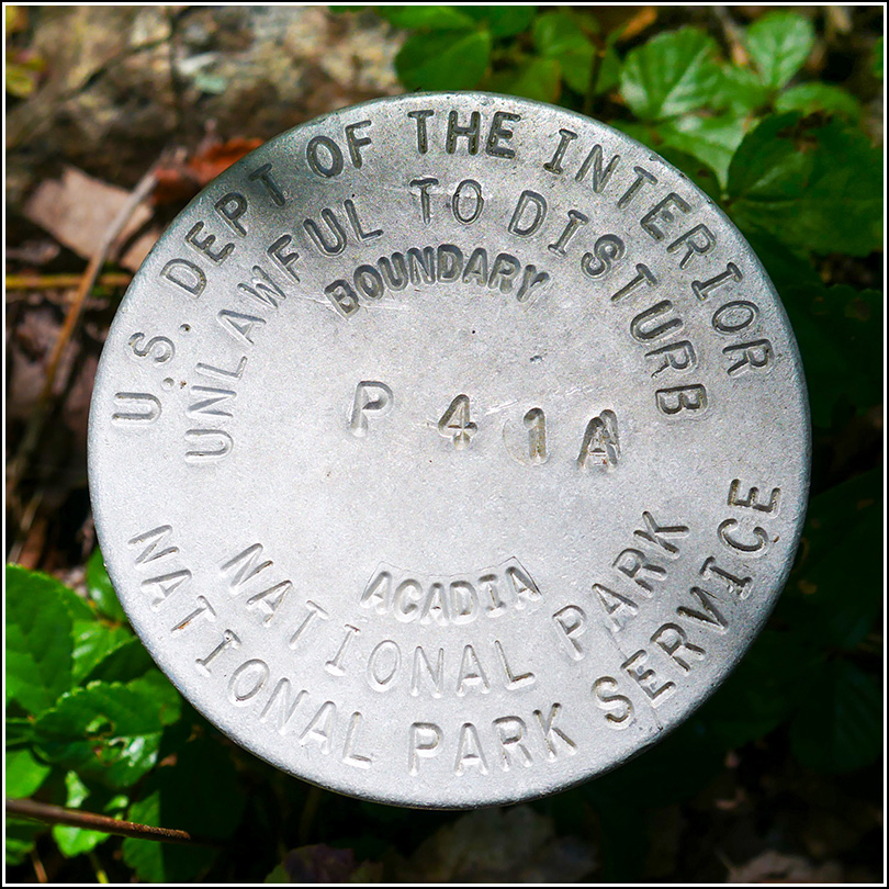
P 41 A
P 41 A
Spatial/elevation data
| Coordinates | N 44.389666° W 68.225722° |
| Elevation | Unknown |
| Location | Maine
Hancock County Bar Harbor Quad |
Mark description
| Type | Boundary Monument |
| Setting | Pipe Cap |
| Monumented | Unknown by National Park Service |
Narrative and photographs
This relatively new NPS boundary marker was found along a small stretch of abandoned road in the woods between Bloomfield Road and Duck Brook Road. A local blogger has called this an “abandoned entrance” into the park. Although it is clearly an abandoned stretch of road, that description is a bit more dramatic than I think is warranted. To me, it just looks like a section of what was called the “New Eagle Lake Road” on the 1942 topo map (now called Duck Brook Road), that has since been closed off and abandoned, for whatever reason. I suppose the fact that West Street Extension had not yet been constructed may have made this a somewhat more direct way into the park. This area is crisscrossed with short intersecting roads (Champlain Road, Bloomfield Road, Highbrook Road, Cleftstone, etc.) that will be familiar to MDI historians. Several of these roads bounded Woodbury Park, a popular destination at one point in the park’s history, as it was a beginning point for hikes to Great Hill and other nearby points of interest. This boundary marker is in good condition.


