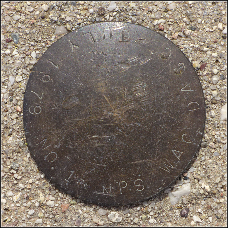
NPS WAC DASC No. 1
NPS WAC DASC No. 1
Spatial/elevation data
| Coordinates | N 31.568249° W 111.050816° |
| Elevation | Unknown |
| Location | Arizona
Santa Cruz County Tubac Quad |
Mark description
| Type | Unspecified Disk |
| Setting | Round Concrete Monument |
| Monumented | 1979 by National Park Service |
| Description (National Park Service) | Unavailable. |
Narrative and photographs
This was our second unexpected find at Tumacacori National Monument. It’s always a thrill for me to find a survey mark near a neat historical site, and this one at Mission San José was especially nice. We happened to spot it in the open lawn in front of the church. I darted toward it, and a minute later spotted the ants crawling all over the site. I retreated very quickly, thinking that they looked an awful lot like the fire ants that attacked me during a benchmark recovery last year in Florida! I was content, at that point, to keep my distance and simply try taking a few zoomed- in photos for basic documentation.
But as we explored the mission grounds, we noticed the same ants crawling all along the sidewalks and other open areas, and they weren’t aggressive in the least. A few of them crawled over my feet and didn’t bite. It was clear that whatever they were, they weren’t fire ants. We went back and documented the mark as usual.
The mark is a typical small NPS disk set into a round concrete monument. I think this is the first mark I’ve ever found that’s stamped with not only the year but also the month of its monumentation (July 1979). Interesting! The disk and monument are in good condition.
The WAC in the stamping may refer to the Western Archeological and Conservation Center. And DASC may refer to the Denver Administrative Service Center, a former service center of the Department of the Interior. Just a guess.

