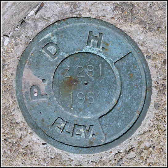
Z 281 (LY1616)
Z 281
Spatial/elevation data
| Coordinates | N 41.24609° W 75.50193° |
| Elevation | 1795.92 ft. |
| Location | Pennsylvania
Lackawanna County Thornhurst Quad |
Mark description
| Type | Bench Mark Disk |
| Setting | Bridge Wingwall |
| Monumented | 1961 by NGS |
| Description (NGS) | NGS Datasheet |
NGS recovery information
Descriptive text
Recovered in good condition as described, on the southeast end of the south abutment of a concrete bridge over Tamarack Creek. U. S. Highway 611 is now PA Route 435 in this area. The trailer park, small pond, and utility pole still exist. Handheld GPS coordinates for the mark are 41 14 45.9(N) 075 30 06.9(W).Narrative and photographs
The other marks we intended to search for today were long shots, so we chose Z 281 as a confidence booster. The description is quite definitive, so we knew the mark would be easy to find—or at the very least, easy to determine if it was gone. After our adventures at St. Catherine’s Cemetery (TT 2 J) and Knecht’s Country Store (X 281), we drove just about 1.2 miles further southeast along Route 435 and easily found the concrete bridge over the small creek (Tamarack Creek). Rich parked on the west shoulder while I crossed and found the mark on the southeast end of the south abutment, as described. The mark is in good condition and is, as described, an old PDH disk that was stamped by NGS. The trailer park and pond still exist at this location. The utility pole also exists but has been renumbered.

