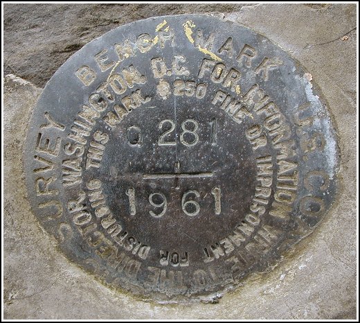
Q 281 (LY1609)
Q 281
Recovered in Good Condition on April 19, 2003
Spatial/elevation data
| Coordinates | N 41.309816° W 75.541833° |
| Elevation | 1856.00 ft. |
| Location | Pennsylvania
Lackawanna County Moscow Quad |
Mark description
| Type | Bench Mark Disk |
| Setting | Bedrock |
| Monumented | 1961 by NGS |
| Description (NGS) | NGS Datasheet |
Narrative and photographs
The historic description leads right to this mark; it seems very little has changed in this area. Even the driving range is still in operation. The disk is easy to spot when driving on Route 307, and for once I didn’t have too much trouble finding a place to park. The disk is in good condition with all stamping legible.

