5 B (LY1479)
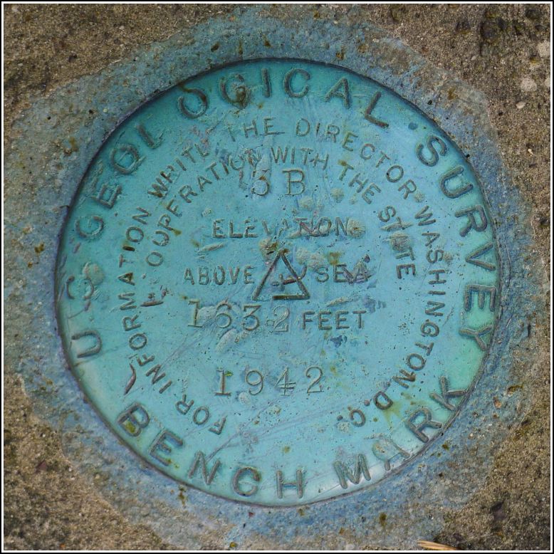
5 B
Spatial/elevation data
| Coordinates | N 41.075696° W 75.958872° |
| Elevation | 1631.27 ft. |
| Location | Pennsylvania
Luzerne County Freeland Quad |
Mark description
| Type | Bench Mark Disk |
| Setting | Bridge Abutment |
| Monumented | 1942 by USGS |
| Description (NGS) | NGS Datasheet |
NGS recovery information
Descriptive text
Recovered in good condition. However, the NGS datasheet is in error regarding the designation and stamping. The disk is actually stamped 3 B and its USGS designation is noted as 3 B in the original USGS description. A USGS bench mark disk designated 5 B was set on this line but its location is in Drums, approximately 4.4 miles south-southwest of 3 B.Narrative and photographs
The Death Hike at the end of May each year gives me a good opportunity to look for marks near Hazleton. It didn’t take long, though, before I had already found most of the local marks or confirmed that they are gone. But this year brought many changes to the Death Hike, and with them came the opportunity to search for marks in a new area.
Due to some unfortunate circumstances in Hazleton, the Monks family moved to a new townhouse in a development northeast of Drums. I saw an interesting BM on the topo map along my route to their new house. The description mentioned an abutment, which I thought I could see on Google’s Street View. It was even more exciting when I realized that the old railroad abutment used to carry the Wilkes-Barre & Hazleton railway, an electric interurban that I’ve been researching, over the road!
I woke up earlier than usual on Death Hike day, leaving plenty of time to search for 5 B. The abutment was easy to find and just slightly tougher to climb, being thickly overgrown with ferns (not a problem) and thorny vines (nasty). The bright blue disk was easy to spot and perfectly clear of debris. When I began to take photos of the mark, I noticed a discrepancy in the stamping. The mark is actually stamped 3 B, not 5 B. At the time I wasn’t sure if the error was in the stamping or on the datasheet. When I checked the USGS datasheets later in the evening, I found that the intended designation of the mark is 3 B (5 B is a few miles south-southwest in Drums), so the NGS datasheet is in error. A gouge on the disk over the character in question explains the ambiguity. It really is difficult to tell if the character is a 3 or a 5.
For the sake of continuity with the NGS database, I’m using the NGS designation 5 B for this mark even though it is technically in error.

