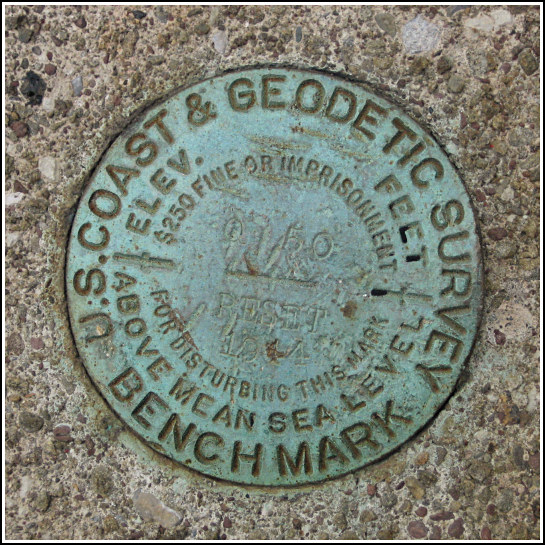
Q 50 RESET 1944 (LY1243)
Q 50 RESET 1944
Recovered in Good Condition on May 18, 2006
Spatial/elevation data
| Coordinates | N 41.474766° W 75.034616° |
| Elevation | 696.4 ft. |
| Location | Pennsylvania
Pike County Rowland Quad |
Mark description
| Type | Bench Mark Disk |
| Setting | Bridge Wingwall |
| Monumented | 1944 by Erie Lackawanna Railroad |
| Description (NGS) | NGS Datasheet |
NGS recovery information
Descriptive text
Mark found in good condition, with the following updates to the description: the railroad is now the Lackawaxen-Stourbridge Railroad, and the creek is named Mill Creek. The mark is 6 inches below the top of the rail, 5.9 feet southeast of the centerline of the tracks and 84 feet east-northeast of the centerline of Rowland Road. Handheld GPS WAAS-corrected coordinates for the mark are: 41 28 29.16(N) 075 02 4.62(W).Narrative and photographs
After checking on a nearby mark that we’d heard might be missing (it wasn’t), Rich and I enjoyed a peaceful drive along the Lackawaxen. The coordinates for this mark were stored in his GPSr, so we decided to take a look even though we didn’t have the datasheet. The mark, set into the south end of the west abutment of a small bridge, was an easy find. It is in fair condition, one edge of the disk having been pried up. The disk is still solid in its setting.


