K 28
K 28
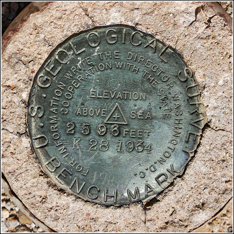
Spatial/elevation data
| Coordinates | N 32.2108° W 111.137° |
| Elevation | 2595.744 ft. |
| Location | Arizona
Pima County Brown Mountain Quad |
Mark description
| Type | Bench Mark Disk |
| Setting | Concrete Post |
| Monumented | 1934 by USGS |
| Description (USGS) |
Narrative and photographs
Next on our list was a short hike to look for a mysterious benchmark depicted with a triangle (typically signifying a triangulation station or other horizontal survey mark) that Rich noticed this morning on our National Geographic map. The hunt for this marker turned out to be another mini-adventure!
With only estimated coordinates and no description to guide us, we decided to hike along the road/trail (Avery Bryce Trail) shown on the map, which should take us very close to the mark, and just keep a close eye out for the monument. According to the map, we could best access this trail from parking pulloff K 15, which was somewhere around the split road near Old Tucson, but we couldn’t find it. We saw lot K 14, and we parked there because we saw a trail heading west that looked like it would have been the old road that became the Avery Bryce trail. We were initially heading right toward the coordinates for the mark but then the trail turned sharply left, south, and we saw a mountain biker heading east on another trail right ahead of us. Confused, I checked my phone and found a website that showed the trail following the same general direction that we were, so we figured it was OK and the trail would eventually swing up north again and then back to head west - which it eventually did. We still couldn’t figure out what had happened, and why it didn’t match what we saw on our trail map.
At some point along the way I realized I just might have a datasheet on my website for this quad, so I pulled out the phone and checked. I had it! So now we had a description to work from. We reached the coordinates (which I had pulled from the topo map) and didn’t see much of any use, but only a few minutes of poking around and I heard Rich yell “I found it!” I had just been checking to see if I had the horizontal datasheet that might have given better coordinates. He had first spotted a rock with a smaller rock balanced on top and thought it might be significant. In looking around for anything else similarly unusual, he spotted three piles of rocks that might have been cairns. A closer look revealed the mark inside the triangle of rocks! What was really cool was that there were the remains of a wooden tripod lashed together with wire at the site. So cool—more survey history finds in the desert!


