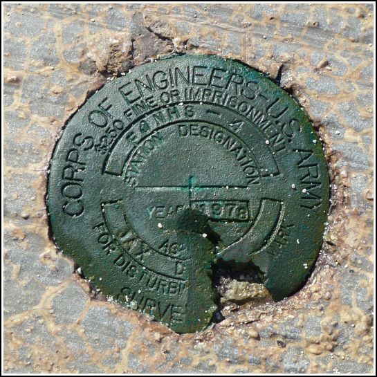
FJNHS - 4
FJNHS - 4
Recovered in Fair Condition on February 22, 2014
Spatial/elevation data
| Coordinates | N 24.62795° W 82.874433° |
| Elevation | Unknown |
| Location | Florida
Monroe County Dry Tortugas Quad |
Mark description
| Type | Survey Mark |
| Setting | Concrete Seawall |
| Monumented | 1978 by Army Corps of Engineers |
| Description (Army Corps of Engineers) | Unavailable. |
Narrative and photographs
This Army Corps of Engineers disk is set in the top of the concrete walkway around the moat on the western side of Fort Jefferson. It is just slightly north of the similar disk FJNHS - 5. This disk is damaged, with a chunk taken out of one side, but it still looks relatively stable and the designation is clearly legible.

