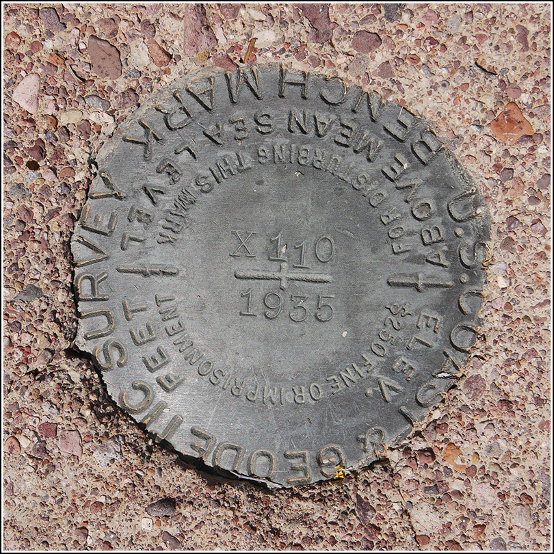
X 110 (DA0372)
X 110
Recovered in Good Condition on March 28, 2019
Spatial/elevation data
| Coordinates | N 32.001° W 112.775555° |
| Elevation | 1847.0 ft. |
| Location | Arizona
Pima County Tillotson Peak Quad |
Mark description
| Type | Bench Mark Disk |
| Setting | Square Concrete Monument |
| Monumented | 1935 by NGS |
| Description (NGS) | NGS Datasheet |
NGS recovery information
Descriptive text
Recovered in good condition. The old Ajo-Sonoyta Road is now a hiking trail accessible from Alamo Canyon Road to the north and Ajo Mountain Drive to the south. The mark is approximately 50 feet, not 398 feet, west of the centerline of the old road (now hiking trail). The witness post was not found.Narrative and photographs
X 110 was our last find for today along the old Ajo-Sonoyta county road. We had hoped to make our way to the next one (Z 309), but it was a little farther than we were prepared to go on such a hot and surprisingly humid—for Arizona—day. We found the mark easily using the USGS coordinates from the topo map, and it is in good condition although the witness post is gone. We discovered an error in the NGS description. It places the mark 398 feet west of the centerline of the road, which is way off. Rich measured it at 17 paces (about 50 feet) west of the centerline of the road. After our hike, we drove the full Ajo Mountain Drive loop, which is always a beautiful and scenic adventure where you’re guaranteed to see many, many organ pipe cacti!

