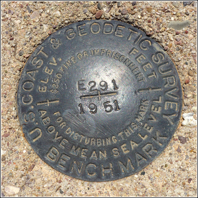
E 291 (CZ1627)
E 291
Spatial/elevation data
| Coordinates | N 32.22074° W 111.14891° |
| Elevation | 2619.9 ft. |
| Location | Arizona
Pima County Brown Mountain Quad |
Mark description
| Type | Bench Mark Disk |
| Setting | Round Concrete Monument |
| Monumented | 1951 by NGS |
| Description (NGS) | NGS Datasheet |
NGS recovery information
Descriptive text
Recovered in good condition. The disk is stamped with a monumentation date of 1951. A wooden stake about 4 ft (1.2 m) south of the marker serves as a witness post.Narrative and photographs
It’s fitting that our first benchmark find on this trip to Arizona would be one that was a bit of a mystery to us. This mark was supposedly "presumed destroyed," but when researching beforehand I could see no reason why it should be, since the area is still undeveloped desert. We couldn’t see the mark on Google Street View, but it was clear that nothing in the area had been disturbed.
Once we reached the area, after this morning’s hike on nearby Brown Mountain, we found the mark exactly as described and in good condition. Also, the date of monumentation is wrong. According to the stamping on the disk it was set in 1951, not 2006 as stated on datasheet.
Because the mark is still officially destroyed, there is no way to link directly to the datasheet in the NGS database. For now, I’ll copy the description here for reference. If we’re successful in getting the mark “un-destroyed” the datasheet will become available again, and I’ll be able to link to it.
Update (10 June 2024): I noticed today while migrating this page to a new platform that the mark’s condition was updated to Good and the datasheet is active again!


