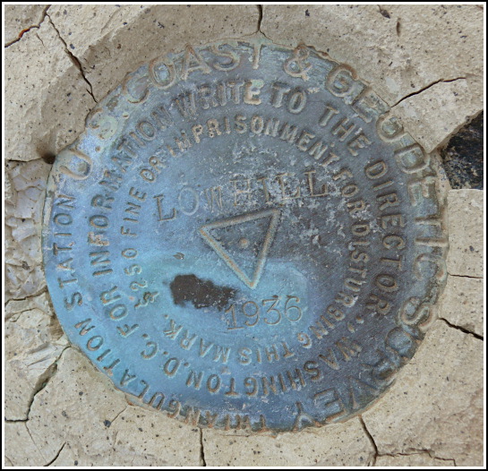
LOW HILL (CH0178)
LOW HILL
Spatial/elevation data
| Coordinates | N 31.991183° W 112.750867° |
| Elevation | 1999 ft. |
| Location | Arizona
Pima County Lukeville Quad |
Mark description
| Type | Triangulation Station Disk |
| Setting | Boulder |
| Monumented | 1936 by NGS |
| Description (NGS) | NGS Datasheet |
NGS recovery information
Descriptive text
The station, both reference marks, and the azimuth mark were recovered in good condition. The land is now part of Organ Pipe Cactus National Monument. Handheld GPS WAAS-corrected coordinates for the azimuth mark are 31 59 19.0(N) 112 45 46.4(W).Narrative and photographs
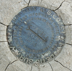
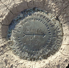
On our first day in Ajo, we decided to do the auto tour of Ajo Mountain Drive. We were a bit late in the day and were concerned that they might close the gate on us before we could complete the loop; fortunately that did not happen. Our slight concern wasn’t enough to prevent us from stopping a few miles in to look for the tri-station LOW HILL on a small knoll very close to the road. The station and both reference marks were found easily and in good condition.
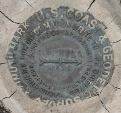
The next day we came back to look for the azimuth mark, which is west of the station (and on the opposite side of the road) on another knoll. This turned out to be a very exciting find! Not only did we find a wooden plank at the site, perhaps part of an old tripod or witness sign, but we also found the remains of some old batteries! They appear to be the type that could have illuminated a target light for surveying from a distance. We thought it was so cool how this had been preserved for decades by the dry desert conditions! Like the station and reference marks, the azimuth mark is in very good condition.


| Designation | Status | Condition | Image |
|---|---|---|---|
| LOW HILL AZ MK | Recovered | Good |
|
| LOW HILL RM 1 | Recovered | Good |
|
| LOW HILL RM 2 | Recovered | Good |
|