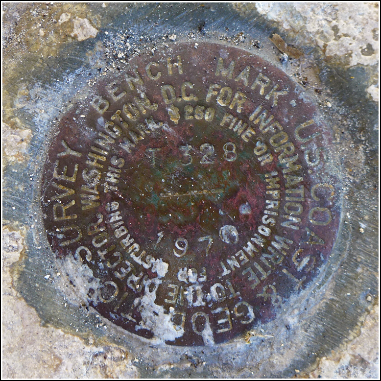
T 328 (AA0158)
T 328
Spatial/elevation data
| Coordinates | N 24.662059° W 81.514555° |
| Elevation | 1.97 ft. |
| Location | Florida
Monroe County Sugarloaf Key Quad |
Mark description
| Type | Bench Mark Disk |
| Setting | Bridge Wingwall |
| Monumented | 1970 by NGS |
| Description (NGS) | NGS Datasheet |
NGS recovery information
Descriptive text
Recovered in good condition. The mark is located on the south wingwall at the east end of the old Bow Channel Viaduct, which is now a fishing pier and part of the Florida Keys Overseas Heritage Trail. The current U.S. Route 1 bridge is directly north of the old bridge.Narrative and photographs
On our way to Bahia Honda this morning, Rich and I checked out the old bridges and fishing piers in search of benchmarks. Unsurprisingly, we found several. At the eastern end of the bridge over Bow Channel, we spotted a disk set into the corner of a wingwall, down near the water. We followed a small gravel footpath down toward the water to view the mark up close.
We both noticed a bike propped up against a tree but didn’t see anyone nearby. I took a few closeup photos of the mark and was maneuvering around to take some wider area views when I heard Rich taking to someone. I looked into the wooded hammock and saw a guy on a hammock (how appropriate!) strung between two trees. He was just hangin’ out, chilling by the water, I guess. He made a few comments about how the fishing was good in that spot, how he had seen minnows in the water and how there are sharks in the area.
The disk is in good condition and is set solidly into the corner of the wingwall, which is also in reasonably good condition.

