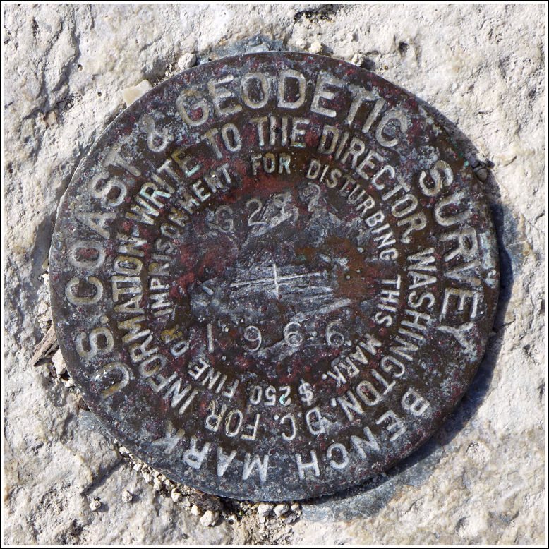
G 272
Recovered in Good Condition on February 21, 2016
Spatial/elevation data
| Coordinates | N 24.660923° W 81.518498° |
| Elevation | 1.94 ft. |
| Location | Florida
Monroe County Sugarloaf Key Quad |
Mark description
| Type | Bench Mark Disk |
| Setting | Bridge Wingwall |
| Monumented | 1966 by NGS |
| Description (NGS) | NGS Datasheet |
NGS recovery information
Descriptive text
Recovered in good condition. The mark is located in the southwest wingwall of the old bridge over Bow Channel. The old bridge is now used as a fishing pier and part of the Florida Keys Overseas Heritage Trail. The mark is adjacent to the Sugarloaf Key/Key West KOA Campground and marina.Narrative and photographs
We really hit the benchmark bonanza at the site of the bridges over Bow Channel. This was the sixth mark we found here today. This NGS bench mark is set into the bottom of the southwest wingwall of the old bridge (now a fishing pier). We walked down a short gravel trail to the KOA marina, where we found the mark set into the wingwall. The marina was hopping with activity on this beautiful February day, but no one seemed very interested in what we were doing. The disk is in reasonably good condition, with some superficial scratches on the surface.

