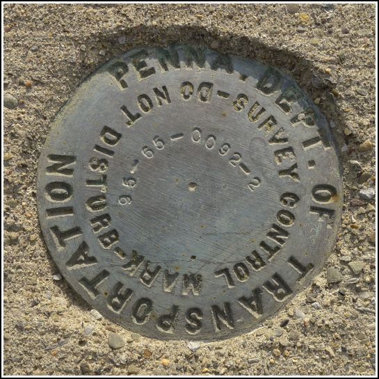
95-65-0092-2
Recovered in Good Condition on October 30, 2014
Spatial/elevation data
| Coordinates | N 41.46107° W 75.85555° |
| Elevation | Unknown |
| Location | Pennsylvania
Wyoming County Ransom Quad |
Mark description
| Type | Survey Control Mark |
| Setting | Bridge Bannister |
| Monumented | 1995? by PennDOT |
| Description (PennDOT) | Unavailable. |
Narrative and photographs
This is the second of two survey marks I found on the Route 92 bridge in Falls. It’s near the southwestern end of the bridge, at a spot overlooking George Hock Memorial Park. The mark is set into the top of the northern bannister of the bridge. Next to it is a metal band stamped with the characters (possibly a highway station number?) 10186 SP2 57.


