7689.51
7689.51
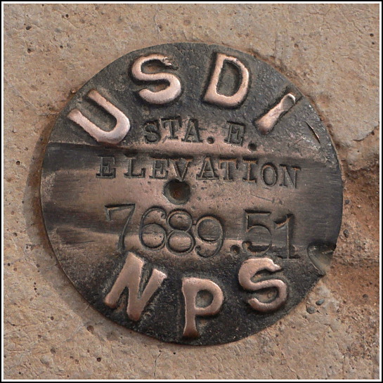
Spatial/elevation data
| Coordinates | N 37.237816° W 108.5038° |
| Elevation | 7689.51 ft. |
| Location | Colorado
Montezuma County Weatherill Mesa Quad |
Mark description
| Type | Elevation Mark |
| Setting | Round Concrete Monument |
| Monumented | Unknown by National Park Service |
| Description (National Park Service) | Unavailable. |
Narrative and photographs
The Far View archaeological sites were the final stop on this afternoon’s mesa tour. The sites are a collection of several structures used by Ancestral Puebloan communities 200 years before the famous Mesa Verde cliff dwellings were constructed. Far View House was the first mesa-top site excavated by Dr. Jesse Walter Fewkes, a noted anthropologist and archaeologist whose studies and excavations focused on the native tribal ruins of the Southwest.
While not specifically covering the Far View excavations, the following works by Fewkes detail some of his explorations in the Mesa Verde area:
The cliff-ruins in Fewkes Cañon, Mesa Verde National Park, Colorado
Antiquities of the Mesa Verde national park, Sprucetree house
The elevation mark is set in a concrete monument that projects several inches above ground level. It’s in a somewhat prominent location that might detract from the experience for some visitors (especially if they trip on it), but for me, because it’s a survey mark, it added another dimension of interest to this day of historical adventures. Rich and I both smiled when we saw it from a distance.


