629-00
629-00
Recovered in Good Condition on May 19, 2007
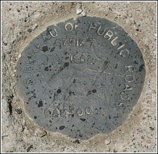
Spatial/elevation data
| Coordinates | N 31.962067° W 111.5998° |
| Elevation | 6751.67 ft. |
| Location | Arizona
Pima County Kitt Peak Quad |
Mark description
| Type | Elevation Mark |
| Setting | Concrete Culvert |
| Monumented | 1962 by U.S. Bureau of Public Roads |
| Description (U.S. Bureau of Public Roads) | Unavailable. |
Narrative and photographs
After visiting Kitt Peak (and making an exciting tri-station recovery there!) we had two more marks in store for us on the way back down the road. We just happened to spot this one on a culvert just off the side of the road. It’s a Bureau of Public Roads mark, which is a new one for us! The disk is in good to fair condition with legible stamping.
