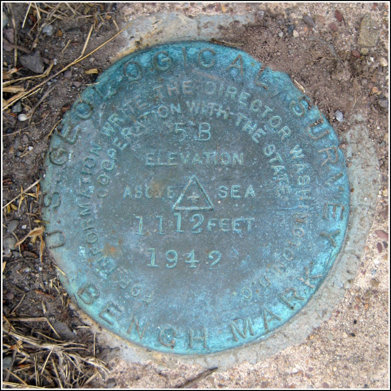
5 B
5 B
Spatial/elevation data
| Coordinates | N 41.01815° W 75.9945° |
| Elevation | 1112.297 ft. |
| Location | Pennsylvania
Luzerne County Freeland Quad |
Mark description
| Type | Bench Mark Disk |
| Setting | Concrete Culvert |
| Monumented | 1942 by USGS |
| Description (USGS) | Drums, 0.2 mi E. of; at SW. corner of cemetery; 20 ft N. and 30 ft E. of crossroads; in headwall of concrete culvert; standard tablet stamped “5 B 1942 1112” Reference mark; 30 ft S. of tablet; 9 ft S. and 27 f E. of crossroads; on headwall of concrete culvert; chiseled square |
Narrative and photographs
I’ve had my eye on this mark since last year’s Death Hike, when I found 3 B nearby on Nescopeck Pass. The NGS datasheet for 3 B is in error and in fact the designation is listed in the database as 5 B (due to partially-illegible stamping on the disk). The USGS datasheets confirm that mark was intended to be 3 B. I was still interested in finding “the real 5 B” even though it is not in the NGS database.
After the traditional pizza lunch, which is an extra reward for a successful Death Hike, I asked Ken to take a detour through Drums and accompany me on my search for the mark. I assured him and Gina that it would be an easy find (or, at the very least, it would be easy to determine if the mark was gone). That was correct. The disk was easy to spot as we drove by. We parked at the church across the street and walked to the culvert at the edge of the cemetery, at the northeast corner of West Butler Drive and Mill Mountain Road. Ken was surprised that the mark had survived all these years so close to the road. I was surprised, too, that the culvert was still original and hadn’t been replaced or rebuilt since the mark was set. The disk is in good condition and is clearly stamped “5 B.”


