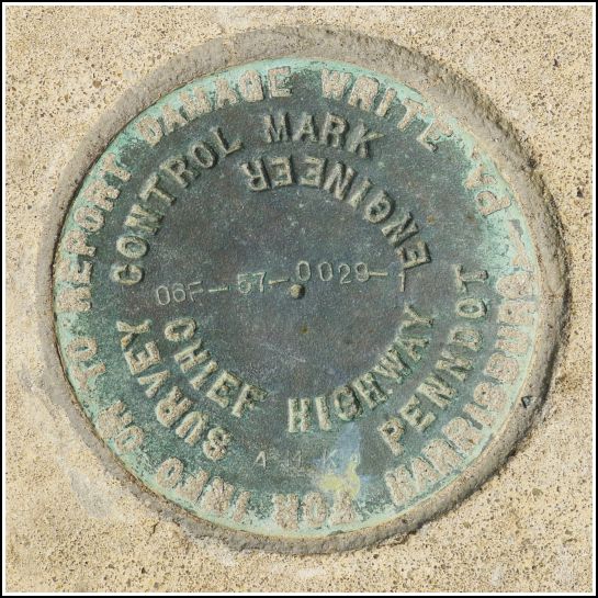
06F-57-0029-1
Spatial/elevation data
| Coordinates | N 41.91787° W 75.84752° |
| Elevation | Unknown |
| Location | Pennsylvania
Susquehanna County Franklin Forks Quad |
Mark description
| Type | Survey Control Mark |
| Setting | Bridge Wingwall |
| Monumented | 2006? by PennDOT |
| Description (PennDOT) | Unavailable. |
Narrative and photographs
The first weekend of August always means Montrose Blueberry Festival (at least for us). This year’s festival was as tasty (blueberry pancakes!) and fruitful ($1.50 cactus pups!) as usual.
Another tradition is that after enjoying the festivities we hike at Salt Springs State Park, which is just a short drive north of Montrose on Route 29. We had planned to search for two USGS benchmarks near the park.
Just before turning west onto Silver Creek Road, we decided to check out the relatively new bridge on Route 29 . No real surprise—we found a PennDOT disk set into the southeast wingwall. It is in good condition. The “57” as the second number in the designation seems to give further evidence for our hypothesis that this part of the designation stands for the county (numbered alphabetically).

