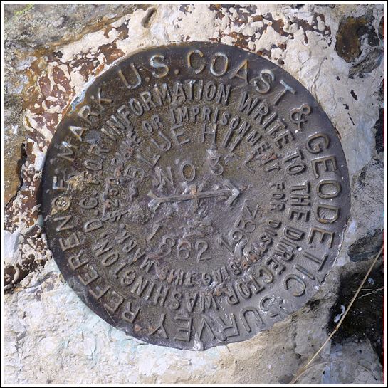
BLUE HILL RM 3 (PE1963)
Recovered in Good Condition on September 10, 2014
Spatial/elevation data
| Coordinates | N 44.43406° W 68.590877° |
| Elevation | 932 ft. |
| Location | Maine
Hancock County Blue Hill Quad |
Mark description
| Type | Reference Mark Disk |
| Setting | Bedrock |
| Monumented | 1960 by NGS |
| Description (NGS) | NGS Datasheet |
NGS recovery information
Descriptive text
This reference mark was recovered in good condition on outcropping bedrock as described. The Blue Hill Heritage Trust now owns and manages part of Blue Hill Mountain including the summit, and the property is open to the public. Several hiking trails lead to the summit. The Forest Service lookout tower was dismantled and removed from the site in 2005.Narrative and photographs
For more information about this reference mark, see its parent mark BLUE HILL RESET.

.")