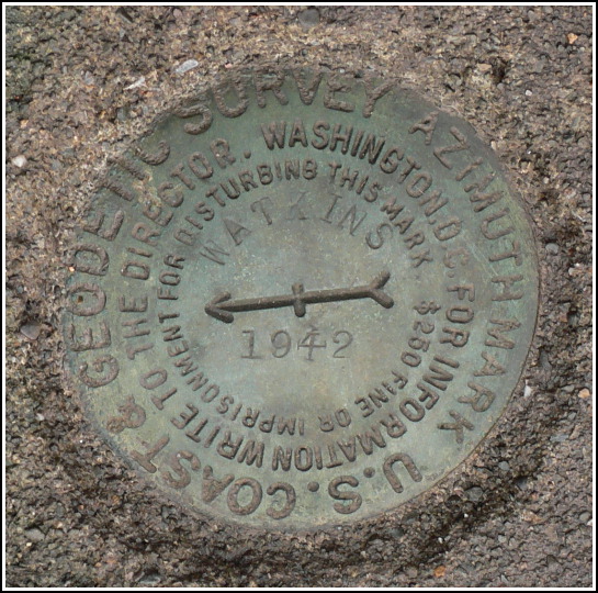
WATKINS AZ MK
Recovered in Fair Condition on November 21, 2007
Spatial/elevation data
| Coordinates | N 41.586066° W 75.719383° |
| Elevation | Unknown |
| Location | Pennsylvania
Lackawanna County Dalton Quad |
Mark description
| Type | Azimuth Mark Disk |
| Setting | Square Concrete Monument |
| Monumented | 1942 by NGS |
Narrative and photographs
For more information about this reference mark, see its parent mark WATKINS.
We took the following measurements, which will be included in the NGS report (to be submitted after we search for the station and reference marks). The azimuth mark is approximately 16 feet at 204 degrees magnetic from the centerline of the road. It is approximately 6 feet at 24 degrees magnetic from a post and wire fenceline. The monument has been disturbed, but the concrete is still solidly embedded in the ground, and the disk itself is in good condition.


