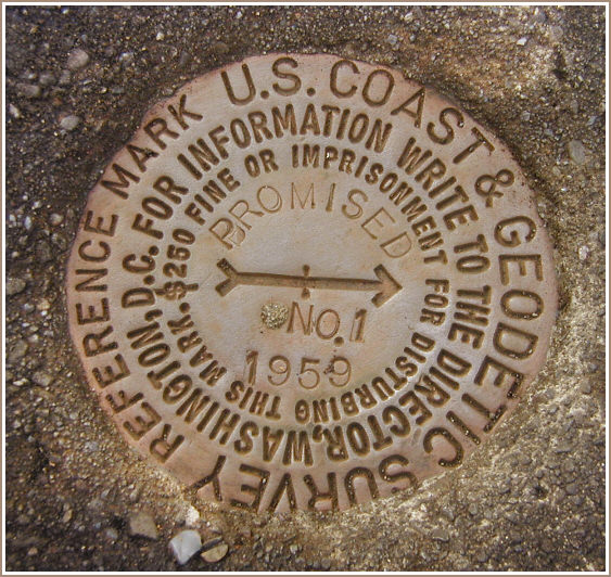
PROMISED RM 1 (LY1162)
Recovered in Good Condition on December 4, 2003
Spatial/elevation data
| Coordinates | N 41.324533° W 75.195833° |
| Elevation | 1868.51 ft. |
| Location | Pennsylvania
Pike County Promised Land Quad |
Mark description
| Type | Reference Mark Disk |
| Setting | Square Concrete Monument |
| Monumented | 1959 by NGS |
| Description (NGS) | NGS Datasheet |
NGS recovery information
Descriptive text
Reference mark 1 was recovered in good condition. It is approximately 13.8 feet south of Rock Oak Trail. The steel witness post still exists, but the blazed tree was not found.Narrative and photographs
For more information about this reference mark, see its parent mark PROMISED.
This mark was found as part of the recovery of station PROMISED, PID LY1163.


Recovered in good condition.
Reference mark PROMISED NO. 1 is set in the top of a square concrete monument nearly flush with the ground, roughly 13.8 feet south of the centerline of Rock Oak Trail. There is no blazed maple tree near the mark. (For photos and details how to reach this mark see: LY1163) ~Rich in NEPA~


