- NGS PID:
- LY2738
- Coordinates:
- N 41.026733° W 75.50495°
- Location:
- Elevation:
- Unknown
- Type:
- Landmark/Intersection Station
- Setting:
- Fire Lookout Tower
- Year Established:
- 1955
- Established By:
- NGS
- Status:
- Recovered
- Condition:
- Good as of October 27, 2002
- Official Description: NGS Datasheet
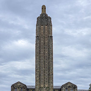
Very easy to find this one! You can't miss it. It's an especially nice tower because visitors are permitted to climb it. (Not that it isn't somewhat unnerving.)
A report on the condition of this survey mark has been submitted to NGS, along with the following recovery note:
Recovered in good condition as described. The tower is located on Delaware State Forest land.