- Coordinates:
- N 44.295917° W 68.238861°
- Location:
- Elevation:
- Unknown
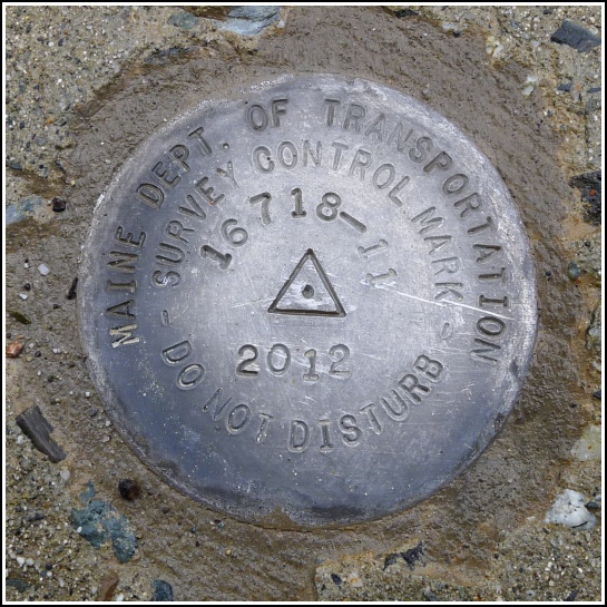
- Type:
- Survey Control Mark
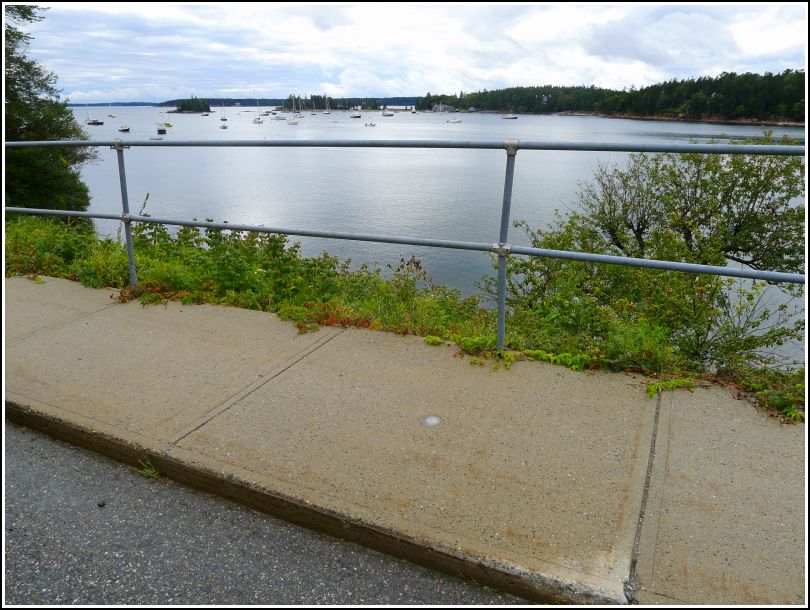
- Setting:
- Concrete Sidewalk
- Year Established:
- 2012
- Established By:
- MaineDOT
- Status:
- Recovered
- Condition:
- Good as of September 8, 2013
-
Official MaineDOT Description:
To reach from the junction of Steamboat Wharf Rd and Rte 3, ABOUT 200' South of junction on Steamboat Wharf Rd. The station is a disk stamped---16718-11 2012---set in concrete sidewalk. IT IS: 13.0' W of CL; 35.2' NNW of man hole cover. BK#381
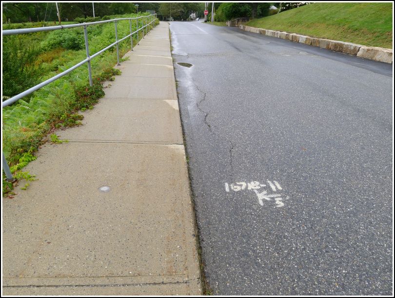
This recently-placed disk is in excellent condition. It is set into the sidewalk along the western side of Steamboat Wharf Rd. in Seal Harbor. At the time of our recovery, the designation 16718-11 was painted onto the roadway with an arrow indicating distance and direction to the disk.