- Coordinates:
- N 44.36235° W 68.18471°
- Location:
- Elevation:
- Unknown
- Type:
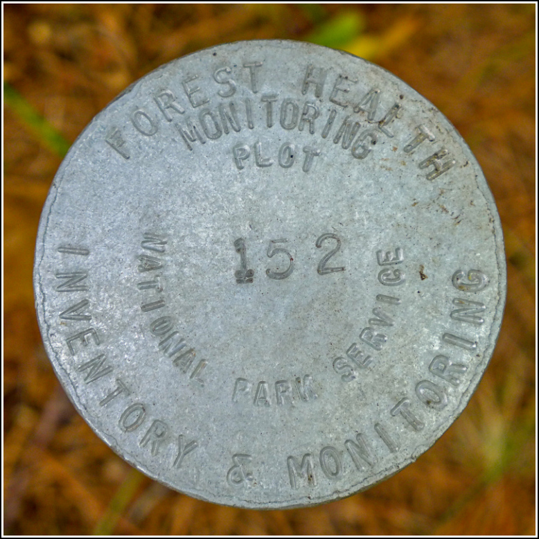
- Forest Health Inventory & Monitoring Disk
- Setting:
- Steel Rod
- Year Established:
- 2013
- Established By:
- National Park Service
- Status:
- Recovered
- Condition:
- Fair as of September 10, 2017
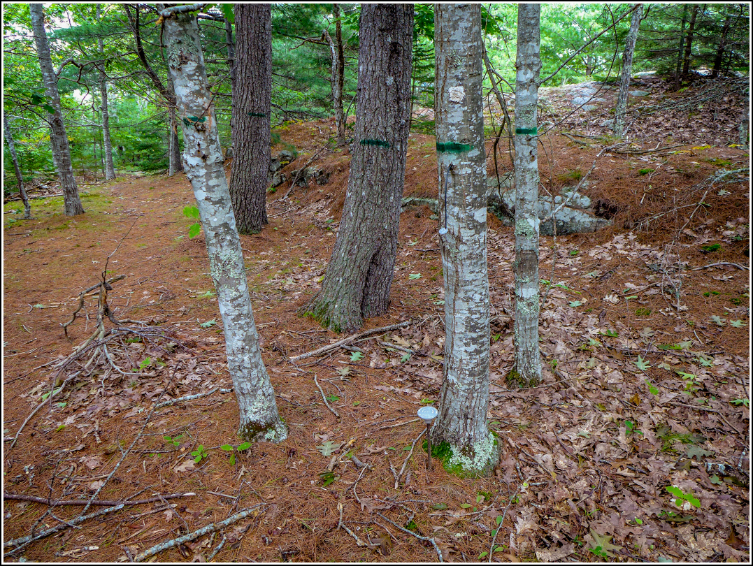
This was an unexpected find while we were exploring a series of old roads and driveways just off Schooner Head Road. We followed the wide, granite-lined driveway up to the rocky summit of a small hill, where we explored some more and took photos. On the way back down, we followed a trail rather than the road, just because we wanted to map out everything we found in the area.
“What’s this?” Rich asked while we were near the top of the trail, pointing to something that to me at a distance looked like a can lid. It was actually a survey disk! It was stamped “FOREST HEALTH” and was surrounded by tagged and blazed trees. Cool! But the disk on its rod was just lying on its side, partially embedded in the soil and pine needle debris. We have no idea where it was supposed to be placed so we just set it in the ground, buried as deep as Rich could force it, next to one of the tagged trees. That's the reason I listed its condition as "Fair." The disk seems fine but we don't know if it's actually in the correct spot. We're hoping that it only serves to mark the general area under study and not precise coordinates.
NPS maintains a website of Forest Health data: Northeast Temperate Network (NETN) Forest Health (choose the Acadia NP tab to see the map). Their description and notes for station 152 are: Rolling Uplands. Red oak, white pine forest on rocky hilltop. Rock wall and old road running through plot.