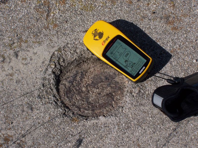
These photos were submitted by Glen Smallwood in March 2015. They show the current status of Salt Lake City to Boise Beacon 25 (NGS PID OZ1042).
BCN 25 at the entrance to the Mountain Home Municipal Airport. The tower appears to match the tower remnants and BCN 26 & BCN 27, however it appears that the majority of the arrow was removed when the entrance was constructed. The original pad appears to be buried under several inches of landscape rock. Seems to dimensionally match the other towers. The only marker on the tower we could find. According to the NGS datasheet, this was located by sighting the light for the center of the tower.
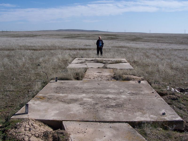
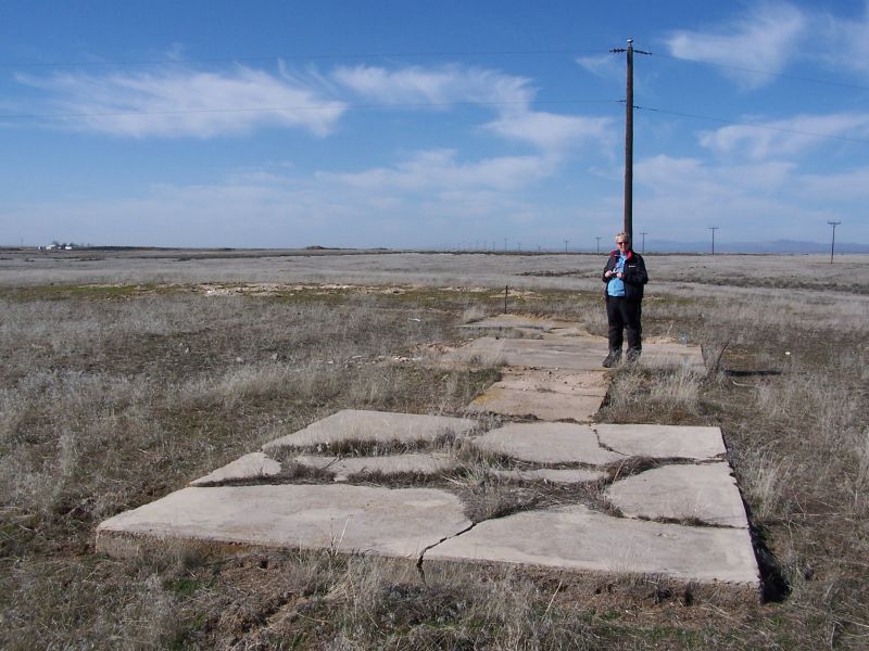
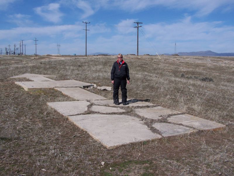
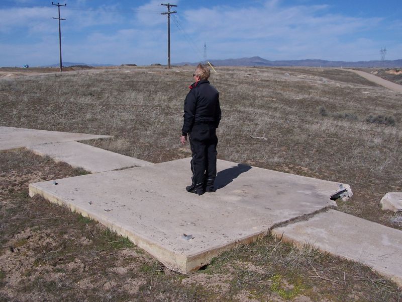
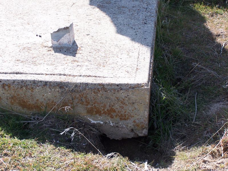
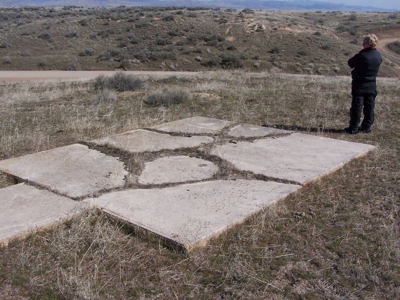
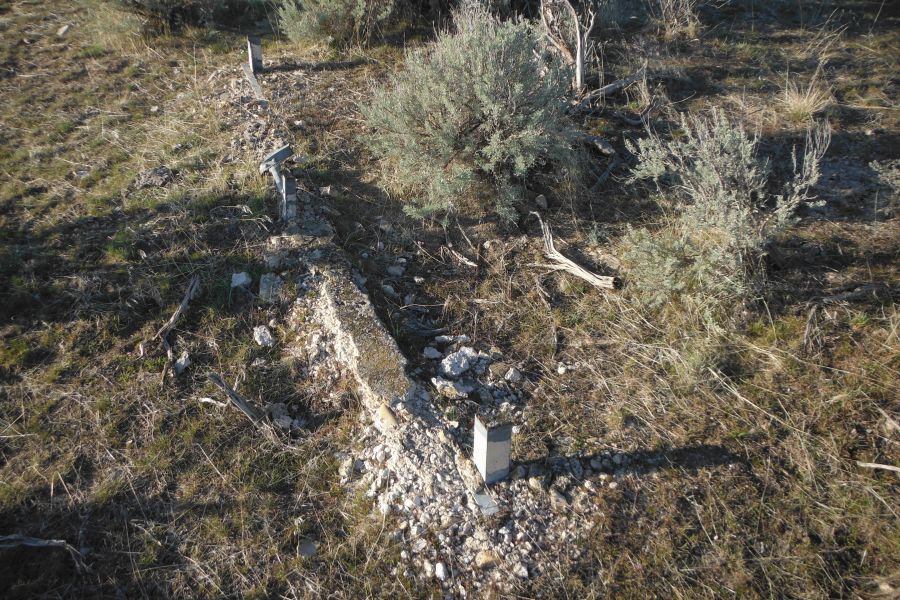
These photos were submitted by Glen Smallwood in March 2015. They show the current status of Salt Lake City to Boise Beacon 26 (NGS PID OZ1045).
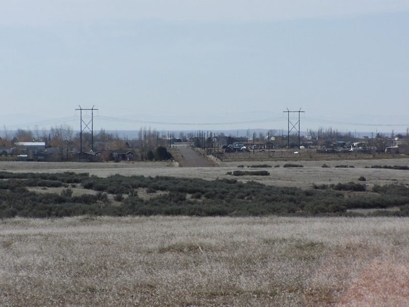
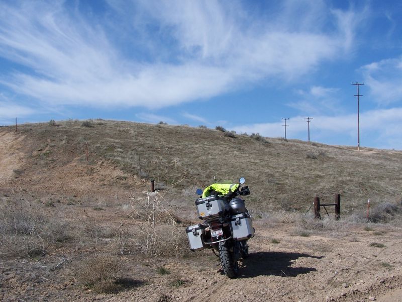
Looking SE from the tail of BCN 26. This marker is identified by the NGS PID OZ1045. Looking NW from BCN 26 BCN 26 showing the turn to BCN 27 From BCN 26 looking East to Sea Breeze Road. News flash for these folks. The breeze left the sea about 500 miles ago. A last look. This marker is about .6 miles from the end of Sea Breeze Road, across open ground. It may be possible to ride out here by following W. Desert Duck Ave. to the power lines, and following power line roads, but the walk did us good. What’s left of the tower. Looking east from the end of Sea Breeze Road
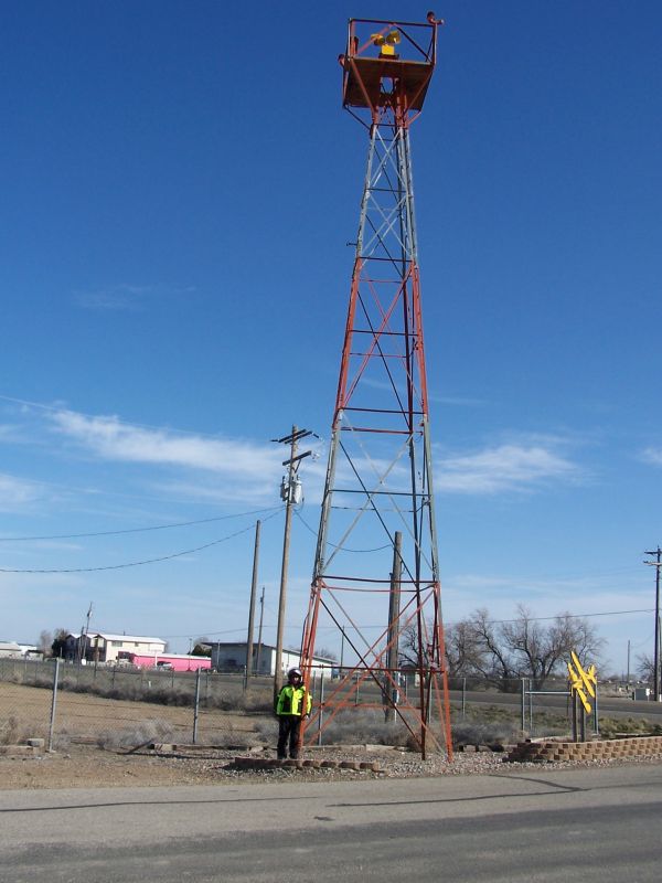
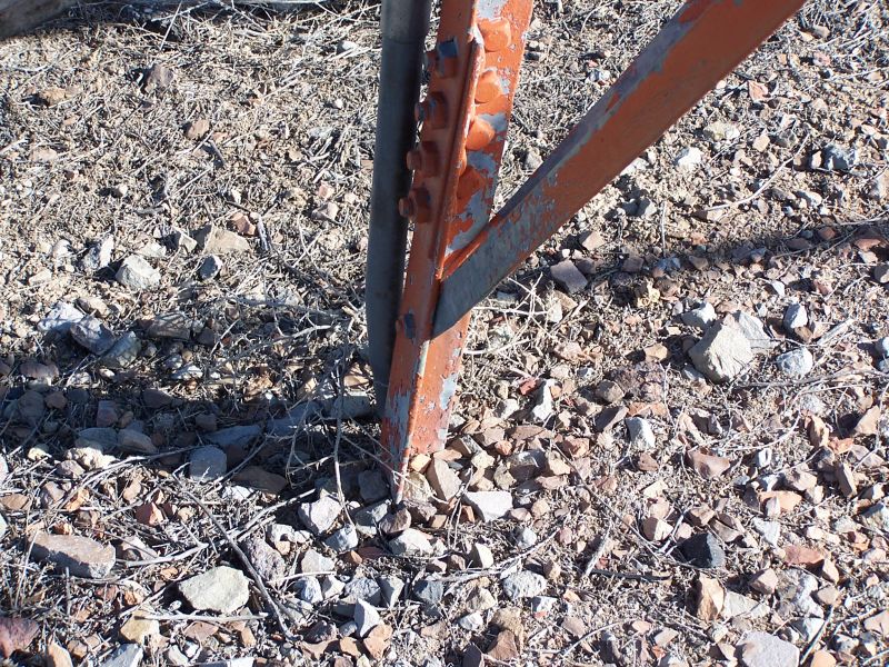
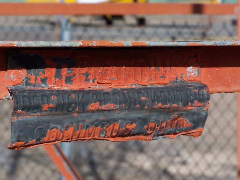
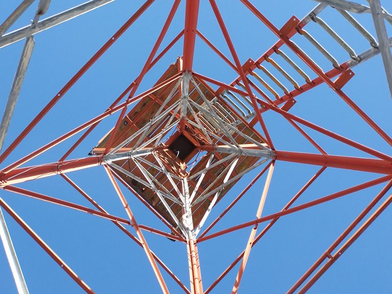
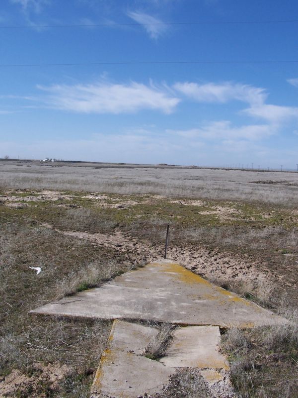
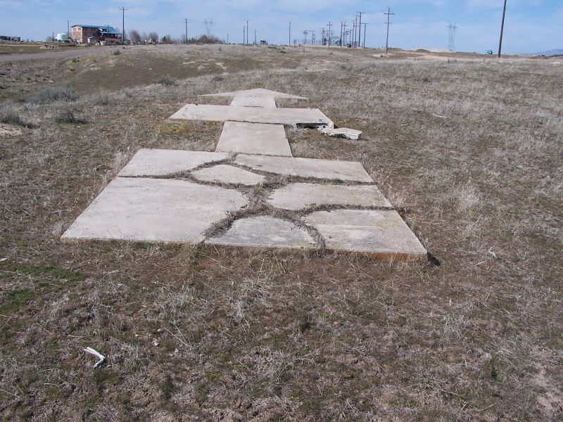
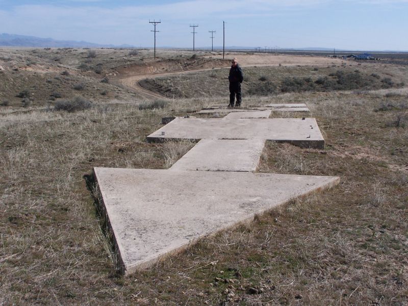
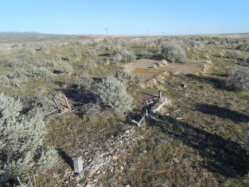
These photos were submitted by Glen Smallwood in March 2015. They show the current status of Salt Lake City to Boise Beacon 27.
This beacon does not have an NGS PID. Airway Map No. 135 (Salt Lake City Utah to Boise Idaho, 1936) was used to identify it.
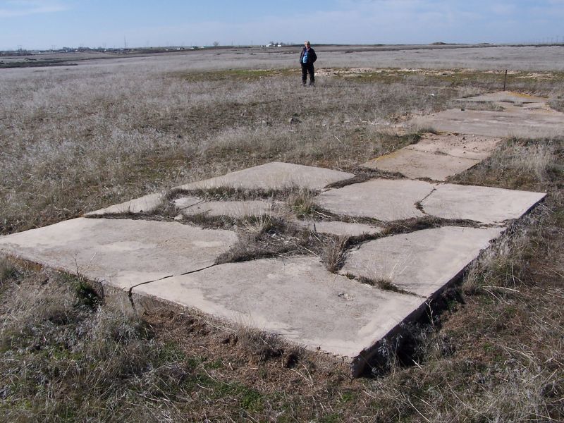
BCN 27 Looking NW. Desert Wind Rd. on the left.Sandy on BCN 27What appears to be the location of an old monument that was set in the concrete pad on the tail of the arrow. Oddly enough, there is no NGS datasheet associated with this marker.Looking SE from BCN 27. The road in the background is to a gravel pit on Regina Rd.Beacon 27 ArrowBeacon 27 ArrowArrow is a shelter for critters. And what’s left of the tower.Tail of BCN 27. The location of the suspected monument is near the center of the pad, however most locations of these monuments according to the NGS datasheets are the center of the tower.Looking South to the intersection of Desert Wind Rd and Regina Rd. The name of the road is different from the name of the old town(?) shown on the topographic maps of the area, which call it out as Regena. Airway Map 135 also describes this as “Regena”.Parking SE of BCN 27 at the base of the hill. The marker is on private ground, but is not signed.
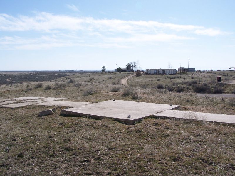
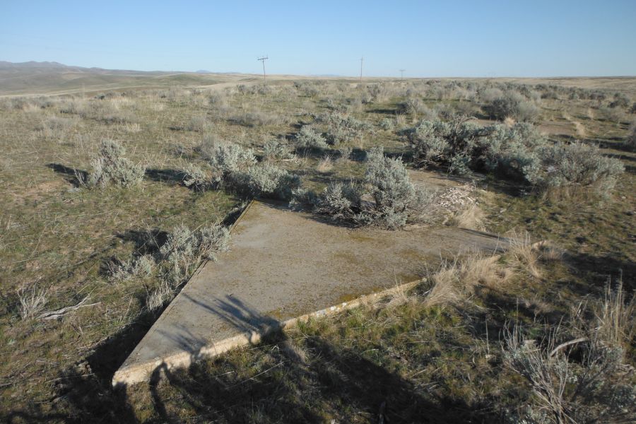
These photos were submitted by Glen Smallwood in March 2015. They show the current status of Salt Lake City to Boise Beacon 29 (NGS PID OH1234).
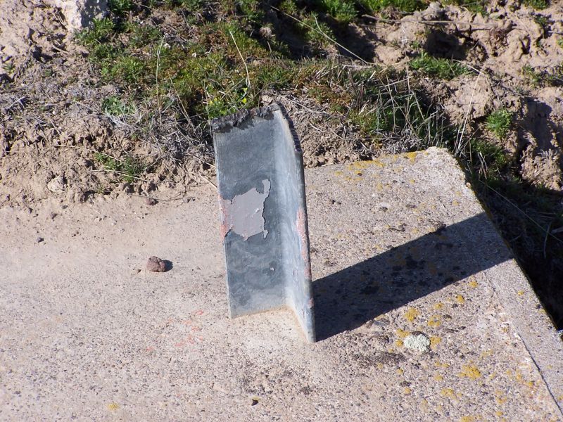
Tail of BCN 29Tip of BCN 29BCN 29 pointing to the airport at Boise (BOI). While the airport at the time the CAM5 contract was in operation is now the Boise State campus, the arrow is pointing to the current airport location. Apparently the general direction was good enough.Tower pad of BCN 29. Not much left except for the steel. This is the first location where I noticed that the ladder had been cast into the concrete.
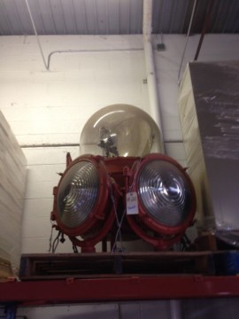
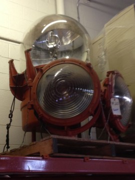
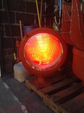
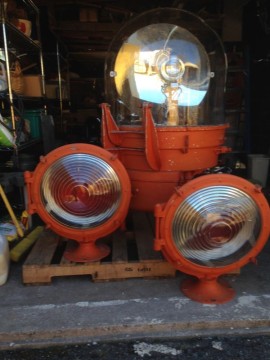
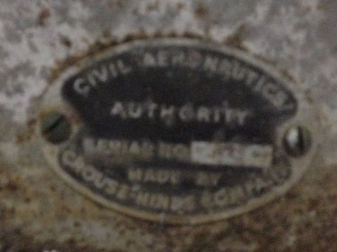
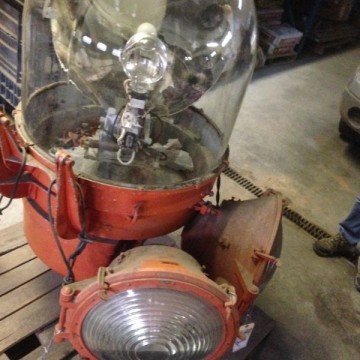
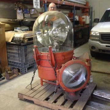
The following photos were submitted by Bill Huber. He has obtained the beacon light from LOS ANGELES DENVER AWY BCN 76A (NGS PID KL0666), a tower in Eagle, Colorado, and would like to know more about it. Bill writes:
I have the Beacon AWY 76A KL0666 of the NGS data sheet. It was in Eagle, Colorado at a elevation of 10,485. the rotating beacon was made by Carouse-Hinds with a serial #135. The two stationary beacons were made by Carlisle Finch with serial #11757. It was removed off the tower by the company I work for about 25 years ago and stored. I would like to get as much info as I can on this beacon.
Photos of the beacon light in its current condition are below (click thumbnails for full-resolution images). Can anyone offer more information?
The lat/lon position given by the NGS data sheet[1] for Richmond—Washington Airway Beacon 52 does not match the description given. Why? I did some research and these are my findings. So where was it actually located?
First possible answer
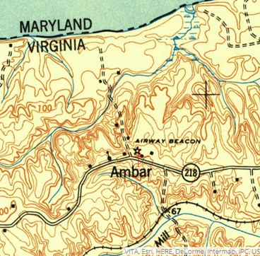
A portion of a 1948 USGS topgraphic map of Nanjemoy, MD quad
The NGS data sheet[1] says Richmond—Washington Beacon 52 was located at POSITION - 38 19 33.47086(N) 077 10 38.12877(W). This is the present day location of Caledon State Park in King George County, Virginia.
A 1948 USGS topo map titled “Nanjemoy”[2] seems to agree with the coordinates given by the NGS data sheet, but it only shows “Airway Beacon”. It does not specify Beacon 52.
But wait. Something isn’t right! The description given in the NGS data sheet describes the location as follows:
"IT IS ON THE TIP OF A POINT OF LAND, ON THE W BANK OF THE POTOMAC RIVER, ABOUT 3.5 MILES E OF THE SMALL VILLAGE OF BROOKE."
The description given of the location by NGS does not match the coordinates given. The coordinates given by the NGS data sheet are not on the tip of a point of land, and they are not 3.5 miles east of Brooke. The given coordinates are nearly 12 miles southeast of Brooke.
Second possible answer
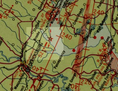
Air Navigation Map No. 59, Washington, D.C. to Savannah, Ga., 1936
An aeronautical strip map[3] of the Richmond to Washington route shows beacon 52 (as described by the NGS) on a point of land 3.5 miles east of Brooke. This point of land is called Brent Point and is mostly owned by Widewater State Park. Dominion Power had planned to put a power plant there but instead sold it to the state to become Widewater park.
This location for beacon 52 is also corroborated by an air navigation map of the route from Washington to Savannah[4].
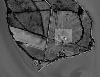
Interesting 1952 imagery
I attempted to use aerial imagery to prove or disprove one location vs. the other. The only imagery-related evidence I found that may cause me to lean one way or the other was this 1952 aerial photo of Brent Point. It’s not a smoking gun by any means—more like a grainy Bigfoot photo. What do you think? Could this be it? The area appears to have been fenced off. Could a tax map of Stafford County shed some light on past ownership of the small parcel?
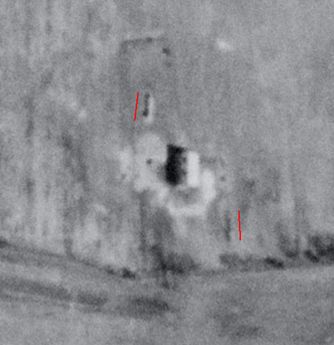
The red lines in the second image are Google Earth’s measuring tool which indicated 50 feet. (Each red line is 50 feet long.) Could one of these two long narrow objects be a concrete arrow? They both appear to have points but in opposite directions.
USGS EarthExplorer, aerial single frame, 1952
Closeup showing unidentified objects
Summary
Beacons along airway
Which was correct? The NGS coordinates or the NGS description? In this writer’s opinion there is strong evidence (though not conclusive) to suggest that beacon 52 was located at Brent Point (the location shown in the air charts[3,4] and as described in the NGS data sheet[1]) and not at the coordinates given in the NGS data sheet. I come to this conclusion for the following reasons:
Brent Point is a much better match of the NGS description of the location being 3.5 miles E of Brooke and on a point of land.
Taking into consideration the path along the beacons, beacon 52 is a better fit at Brent Point than at the NGS coordinates.
Due to a problem with my web host, full-size images currently will not load. Thumbnail images still appear as usual in each survey mark log. I apologize for the inconvenience! I’m working with the hosting company to resolve the issue.


