Today we have a few quads from eastern Wyoming. I’m hoping to obtain full state coverage at some point, but this is a start!
View Wyoming quads here: USGS Datasheets: Wyoming
(Or view a standalone version of the map.)
Today we have a few quads from eastern Wyoming. I’m hoping to obtain full state coverage at some point, but this is a start!
View Wyoming quads here: USGS Datasheets: Wyoming
(Or view a standalone version of the map.)
Thanks again to Jeff Jalbrzikowski of NGS, we now have full state coverage for Rhode Island!
View Rhode Island quads here: USGS Datasheets: Rhode Island
(Or view a standalone version of the map.)
Thanks again to Jeff Jalbrzikowski of NGS, we now have full state coverage for New Jersey!
View New Jersey quads here: USGS Datasheets: New Jersey
(Or view a standalone version of the map.)
Thanks to Jeff Jalbrzikowski of NGS, who sent me another large batch of USGS datasheets, we have the scanned datasheets (15′ topo quads) for Delaware! These cover the entire state.
View Delaware quads here: USGS Datasheets: Delaware
(Or view a standalone version of the map.)
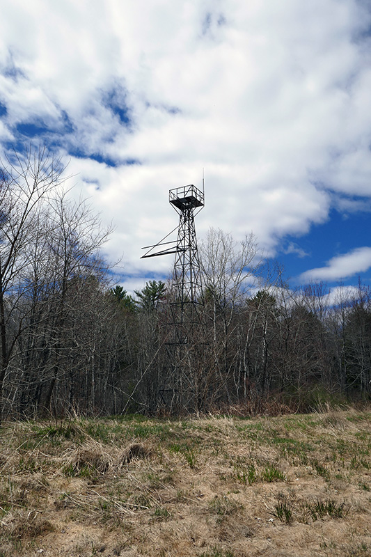
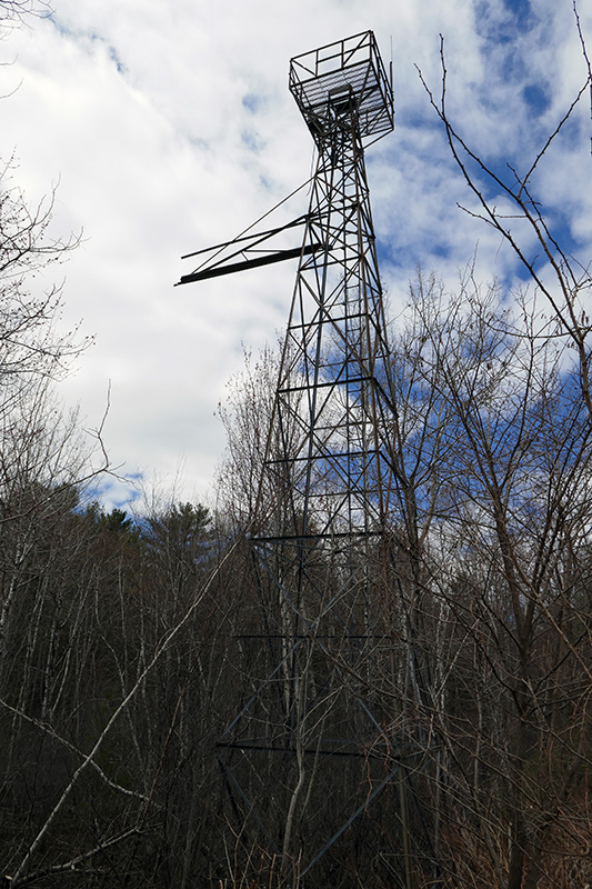
Michael La Rose has submitted some photos showing a beacon tower he spotted adjacent to the Belfast Municipal Airport on Maine National Guard property (but outside their fence).
Michael writes: “The ladder is still intact and goes all the way to the ground so climb if you dare! Sadly I haven’t been able to find any history yet on whether or not it is the original airport beacon or predates the airport which apparently opened in 1943.”
Coordinates for the beacon tower are: N 44.411734°, W 69.010191°.
Thank you for your contribution, Michael!
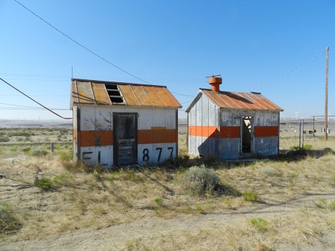
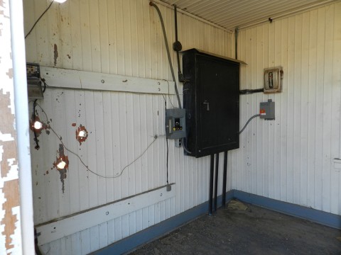
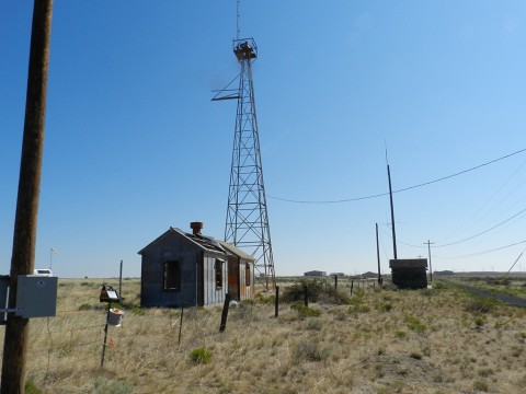
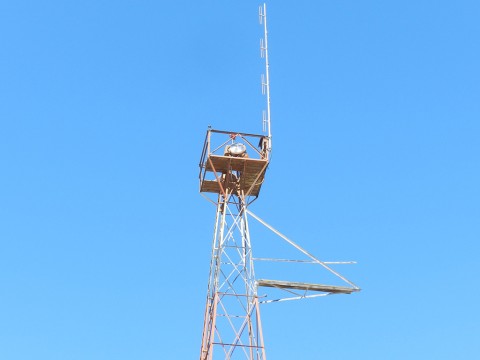
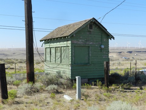
This is a guest post, with photos and accompanying text contributed by Dave Sbur. Thanks for your contribution, Dave!
There was initially some confusion when trying to identify which beacon site Dave visited. We have determined that this was most likely Portland—Spokane #12 (RC2502 in the NGS database, where it is referred to only as ARLINGTON AIRPORT BEACON).
According to Arrows Across America, it appears that there were two locations for beacon #12, the first being RC2505 and the second being RC2502 (although it is not labeled as such on the Arrows Across America website, the coordinates match the site Dave photographed).
Coordinates for this beacon site are N 45.719876°, W 120.186152°.
Dave writes:
All photos were taken August 15, 2020. It’s all kind of a jewel in the rough; I was surprised to find it all in somewhat decent condition considering the age. Arlington is kind of a sleepy town, the airport is still active but is hardly used. There is a drone company that uses it for development, I understand.
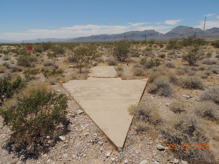
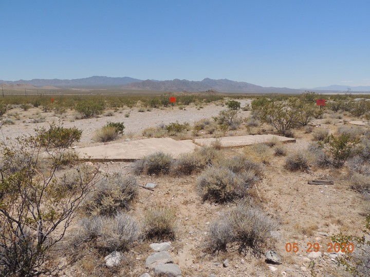
If you look closely you can see some faint numbers on the roofs of the sheds for the Portland-Spokane Airway, part of the C.A.M. 32 route. No trace of a concrete arrow could be found on the site. The airport was listed in the Dept. of Commerce listings in 1931 as a DOCILF (Dept. of Commerce intermediate landing field). It was also used as an Army Air Force auxiliary field in WW2. According to the book Arlington, Child of the Columbia by Marion T. Weatherford there was a strafing range about a mile west of town the military used for practice during the war.
“Department of Commerce intermediate field, site 12, Portland-Spokane Airway. One and one-fourth miles E. Altitude, 850 feet. Irregular shape, 2,400 feet E./W., 2,000 feet NW./SE., sod, level, natural drainage; entire field available. Directional arrow marked “12 P-S.” Pole line to N., beacon tower to NW. Beacon, boundary, approach, and obstruction lights. Beacon, 24-inch rotating, with green course lights flashing characteristic “2” (.._). Aviation fuel. No other servicing facilities. Teletypewriter. Department of Commerce marker beacon, characteristic signal “H” (. . . .), operating frequencies 248 and 278 kc.”
With the above from a 1931 source, I found the discrepancies of the ‘beacon tower to NW’ when it appears to be to the SW. Perhaps things were moved sometime in the past? The altitude on the power shed is crudely painted 877′ when the listing show 850′ (current FAA listing show 890′). I found no evidence of a ‘Pole line to N’. There are various runway markers. I did not look for approach or obstruction lights evidence.
Image captions in the gallery below give more details about the various parts of the installation.

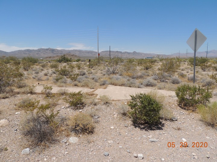
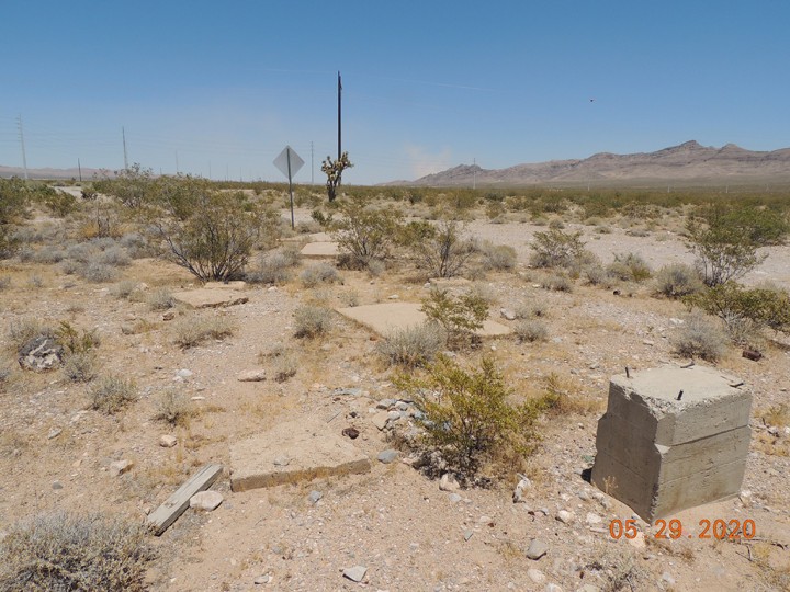
Coordinates for this beacon site are N 35.740218°, W 115.352291°.
Thanks to Will Awalt of Jones|Carter, we have some new benchmark data for Texas! These documents are also available on the Local Control Monument Databases page.
Today we have the scanned USGS datasheets (15′ topo quads) for New York! Big thanks to Jeff Jalbrzikowski of NGS, who sent me the files.
Coverage of the state is nearly complete; Neversink is the only quad that wasn’t available.
There are some very interesting datasheets in this collection. For example, check out the marks on the Statue of Liberty’s pedestal (New Brunswick quad, page 11). And West Point contains some really interesting history and diagrams from the U.S. Military Academy.
View New York quads here: USGS Datasheets: New York
(Or view a standalone version of the map.)
Today I’m posting my index map to the USGS datasheets for North Carolina!
Big thanks to website contributor Evans Ralston, who alerted me to these datasheets posted on the website of the North Carolina Geodetic Survey.
View North Carolina quads here: USGS Datasheets: North Carolina
(Or view a standalone version of the map.)